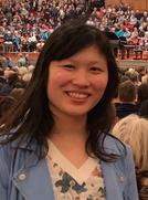
Meng Lu is Junior Professor for Geoinformatics – Spatial Big Data
Junior Professor Dr. Meng Lu leds the Geoinformatics – Spatial Big Data research group at the Faculty of Biology, Chemistry & Earth Sciences.
Meng Lu took up the junior professorship Geoinformatics - Spatial Big Data at the Faculty of Biology, Chemistry & Geosciences at the University of Bayreuth on 1 April 2021.
priv.
Junior Professor Dr. Meng Lu researches environmental science and geoinformatics. Her background is in remote sensing and information engineering, and she has a strong research interest in spatial and temporal data analytics and management techniques. In 2017, she received her doctorate from the Institute of Geoinformatics, University of Münster. There, she worked on information integration and change modelling from multidimensional spatiotemporal arrays. Afterwards, she moved to Utrecht University to continue her research in statistical and machine learning methods for spatiotemporal analysis. In undertaking this research, she immersed herself in environmental science and geo-health applications.
Her most recent research focuses on deep learning-based information integration and computer vision tasks using remote sensing imagery, spatiotemporal prediction of air quality at various scales, and agent-based model development for human exposure assessment. She has been involved in various national and international research projects and has established many successful inter-disciplinary and international collaborations.
Her specialisation in spatial analysis has made her an important contributor in pushing forward new ideas in spatial data science in various domain-specific issues. These include large-scale foliage nitrogen quantification, food environment and health, disease mapping, and geomorphological inter-tidal area classification.
Junior Professor Dr. Meng Lu also enjoys teaching, particularly in spatial and temporal statistics, machine learning for computer vision, digital image processing, and programming with R and Python. Outside work, she is an avid Go player and loves doing sports and playing the piano.

